CCIM Digital Connections
The Official Publication of The CCIM Institute
Image

Image

The Latest Trending Articles
-
Image
 Summer 2024
President's Desk
-
Image

-
Image

-
Image
 Summer 2024
New Commercial Real Estate Certificate Program
-
Image
-
Image

-
Image
 Summer 2024
DEAL MAKERS: Summer 2024
-
Image

Featured Articles by Issue
Stay Up to Date on All Issues
Hero image
Intro Text
FROM ENVIRONMENTAL SCIENTIST TO LAND SALES, GONZALEZ FOUND A SECOND CAREER IN COMMERCIAL REAL ESTATE.
Intro Text
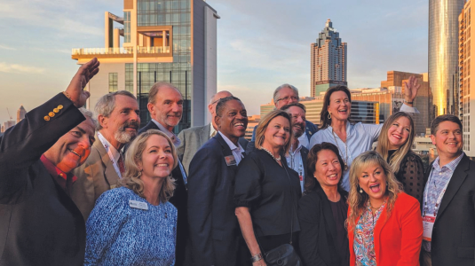
CCIM Designees are traversing the world to make deals happen.
Hero image
Intro Text
Did we get to see you in-person in 2023?
Intro Text
A glimpse into the experiences of two out of the 166 new Designees who were pinned in April 2024.